
Thank you for supporting this site ❤️
Make a donation
Make a donation
Bukit Kemuning topographic map
Click on the map to display elevation.
Thank you for supporting this site ❤️
Make a donation
Make a donation
About this map
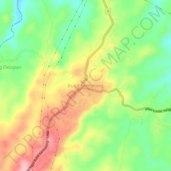
Name: Bukit Kemuning topographic map, elevation, terrain.
Location: Bukit Kemuning, Lampung Utara, Lampung, Sumatra, Indonesia (-4.88007 104.55193 -4.84007 104.59193)
Average elevation: 256 m
Minimum elevation: 183 m
Maximum elevation: 341 m
Thank you for supporting this site ❤️
Make a donation
Make a donation
Other topographic maps
Click on a map to view its topography, its elevation and its terrain.