
Thank you for supporting this site ❤️
Make a donation
Make a donation
Ostrovitsa topographic map
Click on the map to display elevation.
Thank you for supporting this site ❤️
Make a donation
Make a donation
About this map
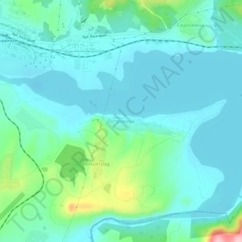
Name: Ostrovitsa topographic map, elevation, terrain.
Location: Ostrovitsa, Kardzhali, 6621, Bulgaria (41.59660 25.39354 41.63660 25.43354)
Average elevation: 254 m
Minimum elevation: 215 m
Maximum elevation: 421 m
Thank you for supporting this site ❤️
Make a donation
Make a donation
Other topographic maps
Click on a map to view its topography, its elevation and its terrain.