
Thank you for supporting this site ❤️
Make a donation
Make a donation
Pirma topographic map
Click on the map to display elevation.
Thank you for supporting this site ❤️
Make a donation
Make a donation
About this map
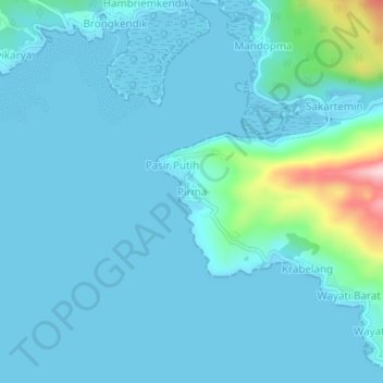
Name: Pirma topographic map, elevation, terrain.
Location: Pirma, Fakfak, West-Papua, West-Neuguinea, Indonesien (-2.97614 132.32793 -2.93614 132.36793)
Average elevation: 31 m
Minimum elevation: -2 m
Maximum elevation: 283 m
Thank you for supporting this site ❤️
Make a donation
Make a donation