
Haslachsimonswald topographic map
Interactive map
Click on the map to display elevation.
About this map
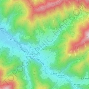
Name: Haslachsimonswald topographic map, elevation, terrain.
Average elevation: 584 m
Minimum elevation: 328 m
Maximum elevation: 1,028 m
Other topographic maps
Click on a map to view its topography, its elevation and its terrain.
Elzach
Duitsland > Baden-Württemberg > Landkreis Emmendingen
Elzach, GVV Elzach, Landkreis Emmendingen, Baden-Württemberg, 79215, Duitsland
Average elevation: 606 m
Simonswald
Duitsland > Baden-Württemberg > Landkreis Emmendingen
Simonswald, VVG der Stadt Waldkirch, Landkreis Emmendingen, Baden-Württemberg, 79263, Duitsland
Average elevation: 740 m