
Thank you for supporting this site ❤️
Make a donation
Make a donation
Agali topographic map
Click on the map to display elevation.
Thank you for supporting this site ❤️
Make a donation
Make a donation
About this map
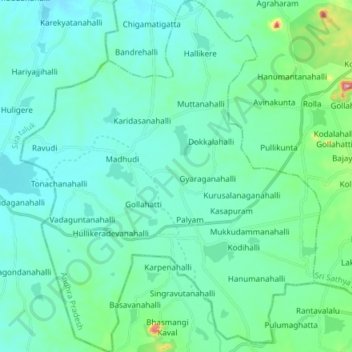
Name: Agali topographic map, elevation, terrain.
Location: Agali, Sri Sathya Sai, Andhra Pradesh, 515311, India (13.73882 76.97645 13.88526 77.10544)
Average elevation: 689 m
Minimum elevation: 646 m
Maximum elevation: 938 m
Thank you for supporting this site ❤️
Make a donation
Make a donation
Other topographic maps
Click on a map to view its topography, its elevation and its terrain.