
Thank you for supporting this site ❤️
Make a donation
Make a donation
Wachendorf topographic map
Click on the map to display elevation.
Thank you for supporting this site ❤️
Make a donation
Make a donation
About this map
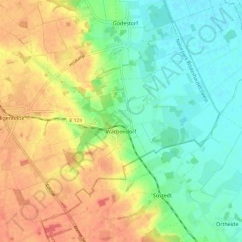
Name: Wachendorf topographic map, elevation, terrain.
Location: Wachendorf, Syke, Landkreis Diepholz, Niedersachsen, Deutschland (52.85533 8.86657 52.89874 8.95208)
Average elevation: 31 m
Minimum elevation: 8 m
Maximum elevation: 58 m
Thank you for supporting this site ❤️
Make a donation
Make a donation
Other topographic maps
Click on a map to view its topography, its elevation and its terrain.