
Thank you for supporting this site ❤️
Make a donation
Make a donation
Vitunj topographic map
Click on the map to display elevation.
Thank you for supporting this site ❤️
Make a donation
Make a donation
About this map
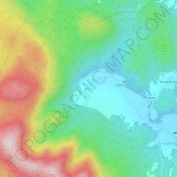
Name: Vitunj topographic map, elevation, terrain.
Location: Vitunj, Grad Ogulin, Карловацкая жупания, 51327, Хорватия (45.26904 15.12407 45.30904 15.16407)
Average elevation: 539 m
Minimum elevation: 327 m
Maximum elevation: 946 m
Thank you for supporting this site ❤️
Make a donation
Make a donation