
Thank you for supporting this site ❤️
Make a donation
Make a donation
Islampur topographic map
Click on the map to display elevation.
Thank you for supporting this site ❤️
Make a donation
Make a donation
About this map
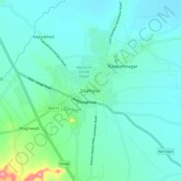
Name: Islampur topographic map, elevation, terrain.
Location: Islampur, Walwa, Sangli District, Maharashtra, 415409, India (17.01022 74.22617 17.09022 74.30617)
Average elevation: 583 m
Minimum elevation: 555 m
Maximum elevation: 730 m
Thank you for supporting this site ❤️
Make a donation
Make a donation
Other topographic maps
Click on a map to view its topography, its elevation and its terrain.