
Thank you for supporting this site ❤️
Make a donation
Make a donation
Nagda topographic map
Click on the map to display elevation.
Thank you for supporting this site ❤️
Make a donation
Make a donation
About this map
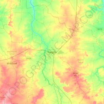
Name: Nagda topographic map, elevation, terrain.
Location: Nagda, Nagda Tahsil, Ujjain, Madhya Pradesh, 456300, India (23.29790 75.25911 23.61790 75.57911)
Average elevation: 484 m
Minimum elevation: 439 m
Maximum elevation: 535 m
Thank you for supporting this site ❤️
Make a donation
Make a donation
Other topographic maps
Click on a map to view its topography, its elevation and its terrain.