
Thank you for supporting this site ❤️
Make a donation
Make a donation
Paliano topographic map
Click on the map to display elevation.
Thank you for supporting this site ❤️
Make a donation
Make a donation
About this map
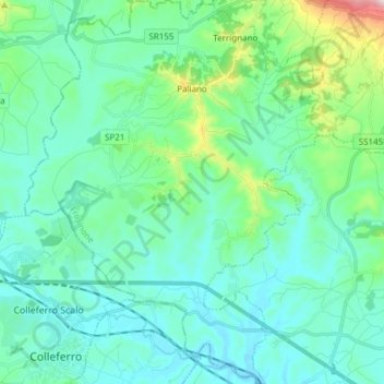
Name: Paliano topographic map, elevation, terrain.
Location: Paliano, Frosinone, Lazio, 03018, Italy (41.71895 12.99187 41.83217 13.10868)
Average elevation: 272 m
Minimum elevation: 183 m
Maximum elevation: 703 m
Thank you for supporting this site ❤️
Make a donation
Make a donation
Other topographic maps
Click on a map to view its topography, its elevation and its terrain.