
Thank you for supporting this site ❤️
Make a donation
Make a donation
White River topographic map
Click on the map to display elevation.
Thank you for supporting this site ❤️
Make a donation
Make a donation
About this map
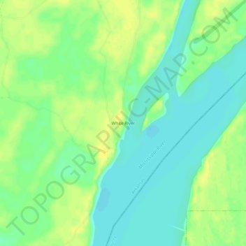
Name: White River topographic map, elevation, terrain.
Location: White River, Desha County, Arkansas, United States (33.86344 -91.08900 33.90344 -91.04900)
Average elevation: 43 m
Minimum elevation: 33 m
Maximum elevation: 53 m
Thank you for supporting this site ❤️
Make a donation
Make a donation
Other topographic maps
Click on a map to view its topography, its elevation and its terrain.
Dumas
United States > Arkansas > Desha County
According to the United States Census Bureau, the city has a total area of 3.2 square miles (8.4 km2), all land. The city is located in the Delta Lowlands sub-region of the Arkansas Delta, producing a topography which is largely flat.
Average elevation: 50 m
Thank you for supporting this site ❤️
Make a donation
Make a donation