
Langley topographic map
Click on the map to display elevation.
About this map
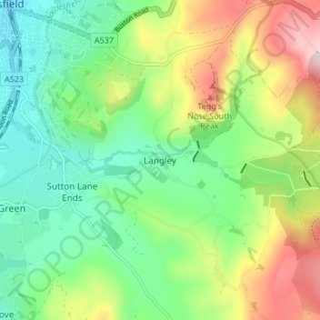
Name: Langley topographic map, elevation, terrain.
Location: Langley, Cheshire East, England, SK11 0DG, United Kingdom (53.22105 -2.11067 53.26105 -2.07067)
Average elevation: 244 m
Minimum elevation: 133 m
Maximum elevation: 447 m
Other topographic maps
Click on a map to view its topography, its elevation and its terrain.