
Thank you for supporting this site ❤️
Make a donation
Make a donation
Anthisnes topographic map
Click on the map to display elevation.
Thank you for supporting this site ❤️
Make a donation
Make a donation
About this map
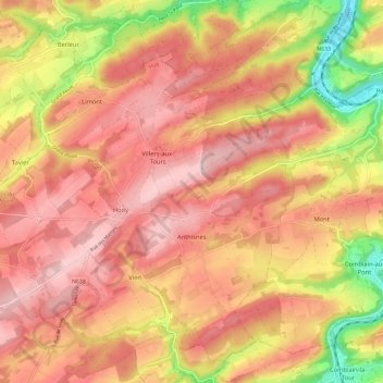
Name: Anthisnes topographic map, elevation, terrain.
Location: Anthisnes, Huy, Lüttich, Wallonien, Belgien (50.45758 5.43790 50.52297 5.55379)
Average elevation: 220 m
Minimum elevation: 82 m
Maximum elevation: 296 m
Thank you for supporting this site ❤️
Make a donation
Make a donation
Other topographic maps
Click on a map to view its topography, its elevation and its terrain.
Thank you for supporting this site ❤️
Make a donation
Make a donation