
Thank you for supporting this site ❤️
Make a donation
Make a donation
Klettarnir topographic map
Click on the map to display elevation.
Thank you for supporting this site ❤️
Make a donation
Make a donation
About this map
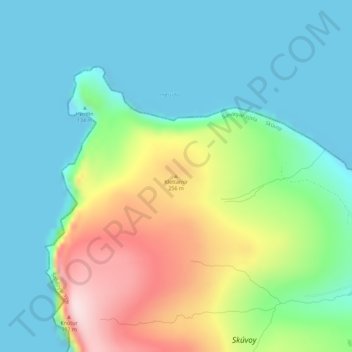
Name: Klettarnir topographic map, elevation, terrain.
Location: Klettarnir, Skúvoy, Sandoyar sýsla, 260, Færøerne (61.77892 -6.83806 61.77902 -6.83796)
Average elevation: 105 m
Minimum elevation: -11 m
Maximum elevation: 366 m
Thank you for supporting this site ❤️
Make a donation
Make a donation