
Les Farges topographic map
Interactive map
Click on the map to display elevation.
About this map
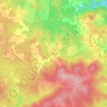
Name: Les Farges topographic map, elevation, terrain.
Average elevation: 606 m
Minimum elevation: 487 m
Maximum elevation: 682 m
Other topographic maps
Click on a map to view its topography, its elevation and its terrain.
Prailloux
France > Nouvelle-Aquitaine > Corrèze > Moustier-Ventadour
Prailloux, Moustier-Ventadour, Ussel, Corrèze, Nouvelle-Aquitaine, France métropolitaine, 19300, France
Average elevation: 555 m