
Thank you for supporting this site ❤️
Make a donation
Make a donation
Straach topographic map
Click on the map to display elevation.
Thank you for supporting this site ❤️
Make a donation
Make a donation
About this map
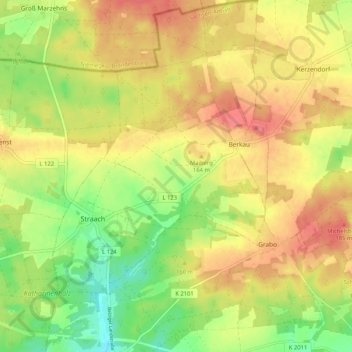
Name: Straach topographic map, elevation, terrain.
Location: Straach, Wittenberg, Sachsen-Anhalt, Deutschland (51.93036 12.58420 51.99431 12.66370)
Average elevation: 148 m
Minimum elevation: 104 m
Maximum elevation: 188 m
Thank you for supporting this site ❤️
Make a donation
Make a donation
Other topographic maps
Click on a map to view its topography, its elevation and its terrain.