
马官桥街道 topographic map
Interactive map
Click on the map to display elevation.
About this map
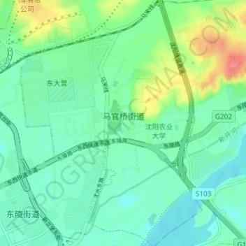
Name: 马官桥街道 topographic map, elevation, terrain.
Location: 马官桥街道, 沈河区, 沈阳市, 辽宁省, 中国 (41.80048 123.53096 41.84561 123.57578)
Average elevation: 61 m
Minimum elevation: 43 m
Maximum elevation: 107 m