
Thank you for supporting this site ❤️
Make a donation
Make a donation
Ibra topographic map
Click on the map to display elevation.
Thank you for supporting this site ❤️
Make a donation
Make a donation
About this map
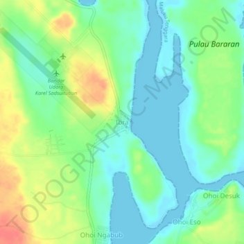
Name: Ibra topographic map, elevation, terrain.
Location: Ibra, Maluku Tenggara, Moluques, Indonésie (-5.78659 132.75053 -5.74659 132.79053)
Average elevation: 19 m
Minimum elevation: -3 m
Maximum elevation: 54 m
Thank you for supporting this site ❤️
Make a donation
Make a donation