
Chelle topographic map
Interactive map
Click on the map to display elevation.
About this map
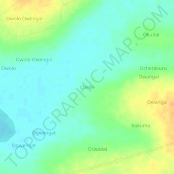
Name: Chelle topographic map, elevation, terrain.
Location: Chelle, Soroti, Eastern Region, Ouganda (1.67564 33.46472 1.71564 33.50472)
Average elevation: 1,045 m
Minimum elevation: 1,032 m
Maximum elevation: 1,066 m