
Golgotha topographic map
Interactive map
Click on the map to display elevation.
About this map
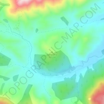
Name: Golgotha topographic map, elevation, terrain.
Location: Golgotha, Selwyn District, Canterbury, Nouvelle-Zélande (-43.46354 171.83446 -43.46344 171.83456)
Average elevation: 410 m
Minimum elevation: 320 m
Maximum elevation: 671 m
Other topographic maps
Click on a map to view its topography, its elevation and its terrain.
Mount Olympus
Nouvelle-Zélande > Canterbury > Selwyn District
Mount Olympus, Selwyn District, Canterbury, Nouvelle-Zélande
Average elevation: 1,631 m