
Thank you for supporting this site ❤️
Make a donation
Make a donation
Ghisar topographic map
Click on the map to display elevation.
Thank you for supporting this site ❤️
Make a donation
Make a donation
About this map
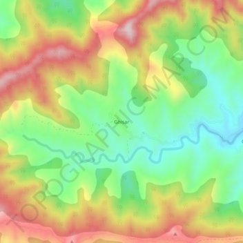
Name: Ghisar topographic map, elevation, terrain.
Location: Ghisar, Velhe, Pune District, Maharashtra, India (18.27260 73.53825 18.31260 73.57825)
Average elevation: 900 m
Minimum elevation: 718 m
Maximum elevation: 1,118 m
Thank you for supporting this site ❤️
Make a donation
Make a donation
Other topographic maps
Click on a map to view its topography, its elevation and its terrain.