
Stall topographic map
Interactive map
Click on the map to display elevation.
About this map
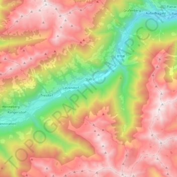
Name: Stall topographic map, elevation, terrain.
Location: Stall, Bezirk Spittal an der Drau, Karinthië, 9832, Oostenrijk (46.81507 12.94430 46.94439 13.11309)
Average elevation: 1,757 m
Minimum elevation: 693 m
Maximum elevation: 2,725 m