
Thank you for supporting this site ❤️
Make a donation
Make a donation
Mount Batur topographic map
Click on the map to display elevation.
Thank you for supporting this site ❤️
Make a donation
Make a donation
About this map
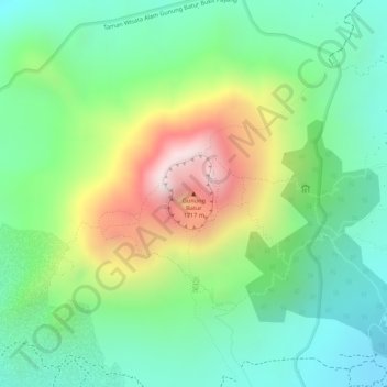
Name: Mount Batur topographic map, elevation, terrain.
Location: Mount Batur, Bangli, Bali, Lesser Sunda Islands, Indonesia (-8.23947 115.37791 -8.23937 115.37801)
Average elevation: 1,301 m
Minimum elevation: 1,074 m
Maximum elevation: 1,693 m
Thank you for supporting this site ❤️
Make a donation
Make a donation