
villege topographic map
Interactive map
Click on the map to display elevation.
About this map
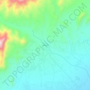
Name: villege topographic map, elevation, terrain.
Location: villege, نادرشاه کوټ ولسوالۍ, Khôst, Afghanistan (33.35460 69.72137 33.39460 69.76137)
Average elevation: 1,484 m
Minimum elevation: 1,371 m
Maximum elevation: 1,852 m