
Thank you for supporting this site ❤️
Make a donation
Make a donation
Lac Mercier topographic map
Click on the map to display elevation.
Thank you for supporting this site ❤️
Make a donation
Make a donation
About this map
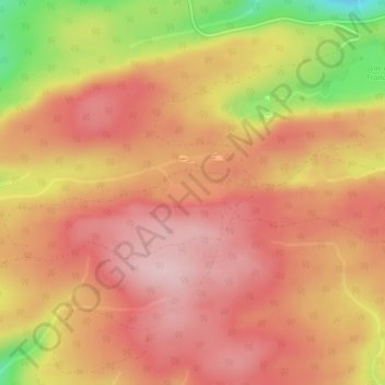
Name: Lac Mercier topographic map, elevation, terrain.
Average elevation: 358 m
Minimum elevation: 197 m
Maximum elevation: 438 m
Thank you for supporting this site ❤️
Make a donation
Make a donation
Other topographic maps
Click on a map to view its topography, its elevation and its terrain.
Manche-d'Épée
Canada > Québec > La Haute-Gaspésie > Sainte-Madeleine-de-la-Rivière-Madeleine
Average elevation: 103 m
Rivière de la Grande Vallée
Canada > Québec > La Haute-Gaspésie > Sainte-Madeleine-de-la-Rivière-Madeleine
Average elevation: 286 m