
La Bigoterie topographic map
Interactive map
Click on the map to display elevation.
About this map
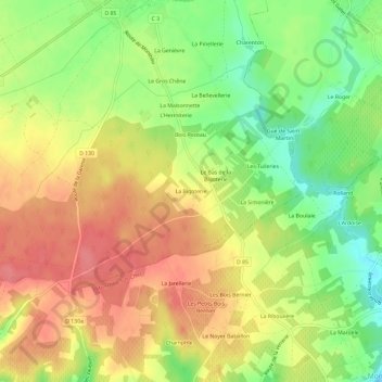
Name: La Bigoterie topographic map, elevation, terrain.
Average elevation: 109 m
Minimum elevation: 70 m
Maximum elevation: 140 m
Other topographic maps
Click on a map to view its topography, its elevation and its terrain.
Les Anglées
France > Centre-Val de Loire > Loir-et-Cher > Pontlevoy
Les Anglées, Pontlevoy, Romorantin-Lanthenay, Loir-et-Cher, Centre-Val de Loire, France métropolitaine, 41400, France
Average elevation: 105 m