
Camanga Island topographic map
Interactive map
Click on the map to display elevation.
About this map
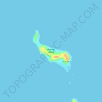
Name: Camanga Island topographic map, elevation, terrain.
Location: Camanga Island, Coron, Palawan, Mimaropa, Philippines (12.34265 120.26097 12.35380 120.27148)
Average elevation: 1 m
Minimum elevation: 0 m
Maximum elevation: 43 m
Other topographic maps
Click on a map to view its topography, its elevation and its terrain.
Bulalacao Island
Philippines > Palawan > Coron
Bulalacao Island, Coron, Palawan, Mimaropa, 5316, Philippines
Average elevation: 12 m
Coron Island
Philippines > Palawan > Coron
Coron Island, Coron, Palawan, Mimaropa, 5316, Philippines
Average elevation: 37 m
Mangroves
Philippines > Palawan > Coron > Borac
Mangroves, Borac, Coron, Palawan, Mimaropa, 5316, Philippines
Average elevation: 45 m