
Thank you for supporting this site ❤️
Make a donation
Make a donation
Dobbins Park topographic map
Click on the map to display elevation.
Thank you for supporting this site ❤️
Make a donation
Make a donation
About this map
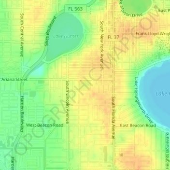
Name: Dobbins Park topographic map, elevation, terrain.
Location: Dobbins Park, Lakeland, Polk County, Florida, United States (28.02408 -81.96329 28.02586 -81.96122)
Average elevation: 58 m
Minimum elevation: 39 m
Maximum elevation: 72 m
Thank you for supporting this site ❤️
Make a donation
Make a donation
Other topographic maps
Click on a map to view its topography, its elevation and its terrain.