
相馬郡 topographic map
Interactive map
Click on the map to display elevation.
About this map
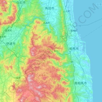
Name: 相馬郡 topographic map, elevation, terrain.
Location: 相馬郡, Prefectura de Fukushima, 東北地方, Japón (37.59338 140.64487 37.97509 141.22148)
Average elevation: 208 m
Minimum elevation: -3 m
Maximum elevation: 895 m
Other topographic maps
Click on a map to view its topography, its elevation and its terrain.