
Thank you for supporting this site ❤️
Make a donation
Make a donation
Jiaming Lake topographic map
Click on the map to display elevation.
Thank you for supporting this site ❤️
Make a donation
Make a donation
Jiaming Lake
This oval-shaped lake is located along the Southern Cross-Island Highway. The lake surface is 120 meters long and 80 meters wide at an elevation of 3,310 meters. It is surrounded by emerald green forest plantation and wildlife. The area surrounds the lake has lodges and hiking trail with a length of 13 km.
Thank you for supporting this site ❤️
Make a donation
Make a donation
About this map
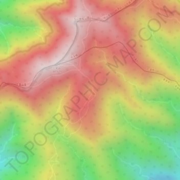
Name: Jiaming Lake topographic map, elevation, terrain.
Average elevation: 3,191 m
Minimum elevation: 2,752 m
Maximum elevation: 3,486 m
Thank you for supporting this site ❤️
Make a donation
Make a donation
Other topographic maps
Click on a map to view its topography, its elevation and its terrain.