
Thank you for supporting this site ❤️
Make a donation
Make a donation
Big Tom Mountain topographic map
Click on the map to display elevation.
Thank you for supporting this site ❤️
Make a donation
Make a donation
About this map
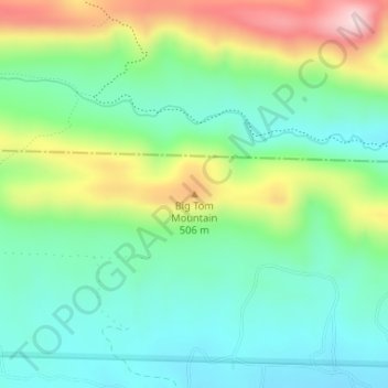
Name: Big Tom Mountain topographic map, elevation, terrain.
Location: Big Tom Mountain, Howard County, Arkansas, United States (34.34807 -93.96690 34.34817 -93.96680)
Average elevation: 378 m
Minimum elevation: 280 m
Maximum elevation: 583 m
Thank you for supporting this site ❤️
Make a donation
Make a donation
Other topographic maps
Click on a map to view its topography, its elevation and its terrain.