
Make a donation
Sørlandet topographic map
Click on the map to display elevation.
Make a donation
About this map
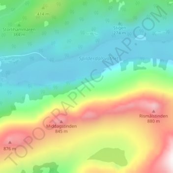
Name: Sørlandet topographic map, elevation, terrain.
Location: Sørlandet, Meløy, Nordland, Norway (66.87050 13.85884 66.87060 13.85894)
Average elevation: 361 m
Minimum elevation: 64 m
Maximum elevation: 972 m
Make a donation
Other topographic maps
Click on a map to view its topography, its elevation and its terrain.
Norway
Norway's topography is defined by its rugged and varied terrain, shaped by ancient geological processes and glacial activity. Dominating the landscape are the Scandinavian Mountains, which run through the country and include peaks like Galdhøpiggen, the highest in Northern Europe at 2,469 meters (8,100 feet).…
Average elevation: 143 m
Finnmark
The county's interior parts are part of the great Finnmarksvidda plateau, with an elevation of 300 to 400 m (980 to 1,310 ft), with numerous lakes and river valleys. The plateau is famous for its tens of thousands of reindeer owned by the Sámi, and swarms of mosquitoes in midsummer. Finnmarksvidda makes up…
Average elevation: 227 m
Pulpit Rock
The walk to Preikestolen is very steep in places. The path starts at the Preikestolhytta, at an elevation of approximately 270 metres (890 ft) above sea level, and climbs to 604 metres (1,982 ft). The walk takes 2–3 hours depending on traffic along the trail, experience, and fitness level. Even though the…
Average elevation: 289 m
Make a donation
Make a donation
Make a donation
Sognefjorden
The inner end of the Sognefjord is southeast of a mountain range rising to about 2,000 metres (6,600 ft) above sea level and covered by the Jostedalsbreen, continental Europe's largest glacier. Thus the climate of the inner end of Sognefjorden and its branches are not as wet as on the outer coastline.…
Average elevation: 806 m
Hamar
Hamar has a humid continental climate (Dfb) with fairly dry and cold winters, and comfortably warm summers. The Hamar II weather station, at an elevation of 141 metres (463 ft), started recording in 1968. The all-time high 33 °C (91 °F) was recorded in July 2018, which was the warmest month on record with…
Average elevation: 445 m
Make a donation
Make a donation
Make a donation
Jan Mayen
Jan Mayen consists of two geographically distinct parts. Nord-Jan has a round shape and is dominated by the 2,277 m (7,470 ft) high Beerenberg volcano with its large ice cap (114.2 km2 or 44 sq mi), which can be divided into twenty individual outlet glaciers. The largest of those is Sørbreen, with an area of…
Average elevation: 23 m
Make a donation
Nordland
In the geological past, a collision with Greenland pushed long slices of the seabed on top of the existing bedrock, today forming the bedrock from Dovrefjell and Trollheimen south of Trondheim stretching north in Trøndelag and through Nordland to justh north of Tromsø. This Cambrian—Silurian bedrock, much…
Average elevation: 259 m
Make a donation
Make a donation
Make a donation
Make a donation
Hardangervidda National Park
The plateau is the largest peneplain (eroded plain) in Europe, covering an area of about 6,500 km2 (2,500 sq mi) at an average elevation of 1,100 metres (3,600 ft). The highest point on the plateau is at the top of the Hardangerjøkulen glacier, which reaches a height of 1,863 m (6,112 ft).
Average elevation: 1,183 m
Make a donation
Make a donation
Make a donation
Make a donation
Make a donation
Make a donation
Make a donation
Make a donation
Make a donation
Make a donation
Make a donation
Make a donation
Make a donation
Make a donation