
Umachiri topographic map
Interactive map
Click on the map to display elevation.
About this map
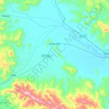
Name: Umachiri topographic map, elevation, terrain.
Location: Umachiri, Provincia de Melgar, Puno, Perú (-15.04647 -70.83440 -14.72386 -70.65909)
Average elevation: 4,109 m
Minimum elevation: 3,891 m
Maximum elevation: 5,180 m
Other topographic maps
Click on a map to view its topography, its elevation and its terrain.