
Thank you for supporting this site ❤️
Make a donation
Make a donation
Pottenbrunn topographic map
Click on the map to display elevation.
Thank you for supporting this site ❤️
Make a donation
Make a donation
About this map
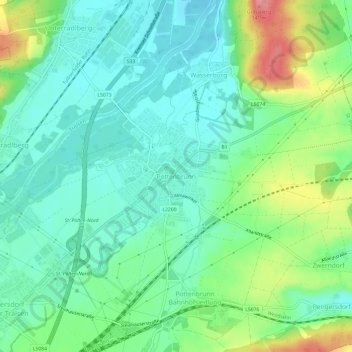
Name: Pottenbrunn topographic map, elevation, terrain.
Location: Pottenbrunn, St. Pölten, Niederösterreich, 3140, Österreich (48.21842 15.67792 48.25842 15.71792)
Average elevation: 261 m
Minimum elevation: 231 m
Maximum elevation: 332 m
Thank you for supporting this site ❤️
Make a donation
Make a donation