
Huis ter Heide topographic map
Interactive map
Click on the map to display elevation.
About this map
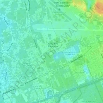
Name: Huis ter Heide topographic map, elevation, terrain.
Location: Huis ter Heide, Zeist, Utrecht, Niederlande (52.10498 5.24325 52.13638 5.28234)
Average elevation: 13 m
Minimum elevation: 3 m
Maximum elevation: 36 m
Other topographic maps
Click on a map to view its topography, its elevation and its terrain.
Den Dolder
Niederlande > Utrecht > Zeist
Den Dolder, Zeist, Utrecht, Niederlande
Average elevation: 7 m