
Thank you for supporting this site ❤️
Make a donation
Make a donation
St. Catharines topographic map
Click on the map to display elevation.
Thank you for supporting this site ❤️
Make a donation
Make a donation
St. Catharines
The most defining transportation icon of St. Catharines is the Welland Canal, a ship canal that runs 43.4 kilometres (27.0 mi), passing through the city. Four of its locks are within city boundaries. The canal allows shipping vessels to traverse the 99.5-metre (326.5 ft) drop in altitude from Lake Erie to Lake Ontario. The Garden City Skyway is a nearby bridge that facilitates vehicle traffic into the city.
Thank you for supporting this site ❤️
Make a donation
Make a donation
About this map
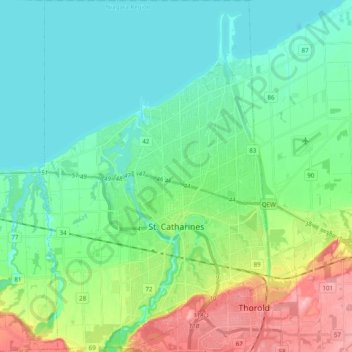
Name: St. Catharines topographic map, elevation, terrain.
Average elevation: 103 m
Minimum elevation: 70 m
Maximum elevation: 195 m
Thank you for supporting this site ❤️
Make a donation
Make a donation