
Make a donation
Hot Springs National Park topographic map
Click on the map to display elevation.
Make a donation
Hot Springs National Park
The National Park Service exercises no control or supervision over any matters connected with the city. The city starts on the other side of Central Avenue from Bathhouse Row. Its development has extended beyond the narrow valley in which the springs are located, spreading out over the open plain to the south and east. The climate is good throughout the year. The elevation of the city is 600 feet (180 m) above sea level, with surrounding hills rising another 600 feet. In the first half of the 20th century, the city operated primarily as a summer resort, but hotels have now long stayed open during the winter due to many northerly patrons coming to escape the winter cold.
Make a donation
About this map
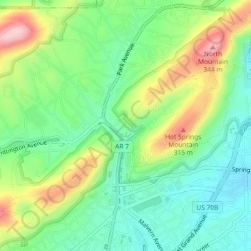
Name: Hot Springs National Park topographic map, elevation, terrain.
Average elevation: 227 m
Minimum elevation: 158 m
Maximum elevation: 346 m
Make a donation
Other topographic maps
Click on a map to view its topography, its elevation and its terrain.