
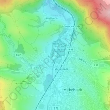
Schloss Fürstenau topographic map
Interactive map
Click on the map to display elevation.
About this map
Name: Schloss Fürstenau topographic map, elevation, terrain.
Average elevation: 245 m
Minimum elevation: 184 m
Maximum elevation: 400 m
Other topographic maps
Click on a map to view its topography, its elevation and its terrain.
Hoher Berg
Deutschland > Hessen > Michelstadt
Hoher Berg, Michelstadt, Odenwaldkreis, Regierungsbezirk Darmstadt, Hessen, 64753, Deutschland
Average elevation: 292 m
Englischer Garten
Deutschland > Hessen > Michelstadt
Englischer Garten, Würzberg, Michelstadt, Odenwaldkreis, Regierungsbezirk Darmstadt, Hessen, 64720, Deutschland
Average elevation: 481 m
Asselbrunn
Deutschland > Hessen > Michelstadt > Asselbrunn
Asselbrunn, Steinbach, Michelstadt, Mossautal, Odenwaldkreis, Hessen, 64720, Deutschland
Average elevation: 287 m