
Thank you for supporting this site ❤️
Make a donation
Make a donation
Nordmarka topographic map
Click on the map to display elevation.
Thank you for supporting this site ❤️
Make a donation
Make a donation
About this map
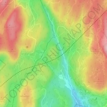
Name: Nordmarka topographic map, elevation, terrain.
Location: Nordmarka, Asker, Comté d'Akershus, 3430, Norvège (59.77763 10.33126 59.77773 10.33136)
Average elevation: 240 m
Minimum elevation: 147 m
Maximum elevation: 329 m
Thank you for supporting this site ❤️
Make a donation
Make a donation
Other topographic maps
Click on a map to view its topography, its elevation and its terrain.