
Esmeralda County topographic map
Interactive map
Click on the map to display elevation.
About this map
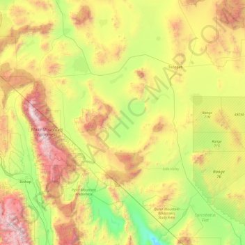
Name: Esmeralda County topographic map, elevation, terrain.
Location: Esmeralda County, Nevada, United States (36.97111 -118.42816 38.47380 -117.16565)
Average elevation: 1,789 m
Minimum elevation: 623 m
Maximum elevation: 4,301 m
Other topographic maps
Click on a map to view its topography, its elevation and its terrain.
Cherry Springs
United States > Nevada > Elko County
Cherry Springs, NV 20, Elko County, Nevada, 89822, United States
Average elevation: 2,062 m
Aurora Hill
Aurora Hill, Mineral County, Nevada, United States
Average elevation: 2,272 m