
Gemeinde Asparn an der Zaya topographic map
Interactive map
Click on the map to display elevation.
About this map
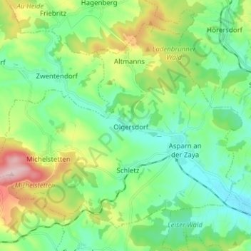
Name: Gemeinde Asparn an der Zaya topographic map, elevation, terrain.
Average elevation: 281 m
Minimum elevation: 202 m
Maximum elevation: 474 m
Other topographic maps
Click on a map to view its topography, its elevation and its terrain.
Asparn an der Zaya
Österreich > Niederösterreich > Bezirk Mistelbach > Gemeinde Asparn an der Zaya > Asparn an der Zaya
Average elevation: 248 m