
Thank you for supporting this site ❤️
Make a donation
Make a donation
Barla topographic map
Click on the map to display elevation.
Thank you for supporting this site ❤️
Make a donation
Make a donation
About this map
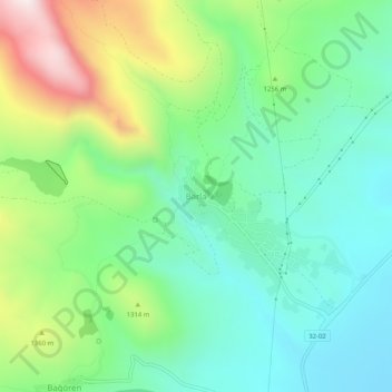
Name: Barla topographic map, elevation, terrain.
Location: Barla, Eğirdir, Isparta, Mediterranean Region, Turkey (37.99914 30.76163 38.03914 30.80163)
Average elevation: 1,196 m
Minimum elevation: 931 m
Maximum elevation: 1,785 m
Thank you for supporting this site ❤️
Make a donation
Make a donation