
Thank you for supporting this site ❤️
Make a donation
Make a donation
Likpe Todome topographic map
Click on the map to display elevation.
Thank you for supporting this site ❤️
Make a donation
Make a donation
About this map
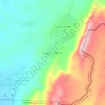
Name: Likpe Todome topographic map, elevation, terrain.
Location: Likpe Todome, Guan District, Oti Region, Ghana (7.15314 0.58275 7.19314 0.62275)
Average elevation: 463 m
Minimum elevation: 274 m
Maximum elevation: 793 m
Thank you for supporting this site ❤️
Make a donation
Make a donation