
Thank you for supporting this site ❤️
Make a donation
Make a donation
Ava topographic map
Click on the map to display elevation.
Thank you for supporting this site ❤️
Make a donation
Make a donation
About this map
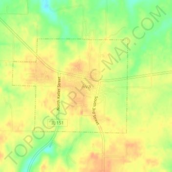
Name: Ava topographic map, elevation, terrain.
Location: Ava, Jackson County, Illinois, United States (37.88103 -89.50954 37.89586 -89.48654)
Average elevation: 177 m
Minimum elevation: 154 m
Maximum elevation: 190 m
Thank you for supporting this site ❤️
Make a donation
Make a donation
Other topographic maps
Click on a map to view its topography, its elevation and its terrain.