
Thank you for supporting this site ❤️
Make a donation
Make a donation
Monte Nero topographic map
Click on the map to display elevation.
Thank you for supporting this site ❤️
Make a donation
Make a donation
About this map
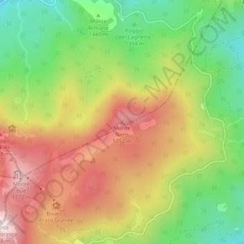
Name: Monte Nero topographic map, elevation, terrain.
Location: Monte Nero, Ferriere, Piacenza, Emilia-Romagna, Italia (44.56186 9.50869 44.56196 9.50879)
Average elevation: 1,504 m
Minimum elevation: 1,233 m
Maximum elevation: 1,792 m
Thank you for supporting this site ❤️
Make a donation
Make a donation