
Thank you for supporting this site ❤️
Make a donation
Make a donation
Big Rock topographic map
Click on the map to display elevation.
Thank you for supporting this site ❤️
Make a donation
Make a donation
About this map
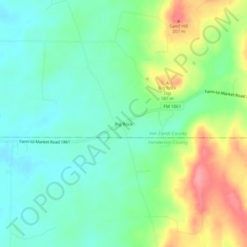
Name: Big Rock topographic map, elevation, terrain.
Location: Big Rock, Van Zandt County, Texas, United States (32.33931 -95.96108 32.37931 -95.92108)
Average elevation: 157 m
Minimum elevation: 126 m
Maximum elevation: 216 m
Thank you for supporting this site ❤️
Make a donation
Make a donation
Other topographic maps
Click on a map to view its topography, its elevation and its terrain.