
Thank you for supporting this site ❤️
Make a donation
Make a donation
Oscura Peak topographic map
Click on the map to display elevation.
Thank you for supporting this site ❤️
Make a donation
Make a donation
About this map
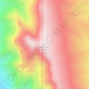
Name: Oscura Peak topographic map, elevation, terrain.
Location: Oscura Peak, Lincoln County, New Mexico, United States (33.64641 -106.37283 33.64651 -106.37273)
Average elevation: 2,323 m
Minimum elevation: 1,787 m
Maximum elevation: 2,625 m
Thank you for supporting this site ❤️
Make a donation
Make a donation
Other topographic maps
Click on a map to view its topography, its elevation and its terrain.
Ruidoso Downs
United States > New Mexico > Lincoln County > Ruidoso Downs
Ruidoso Downs is located in southern Lincoln County at 33°19′54″N 105°35′46″W / 33.33167°N 105.59611°W / 33.33167; -105.59611 (33.331690, -105.596079). It is bordered to the west by Ruidoso. Elevation is 6,420 feet (1,960 m).
Average elevation: 2,091 m