
Thank you for supporting this site ❤️
Make a donation
Make a donation
Carolina topographic map
Click on the map to display elevation.
Thank you for supporting this site ❤️
Make a donation
Make a donation
About this map
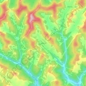
Name: Carolina topographic map, elevation, terrain.
Location: Carolina, Marion County, West Virginia, 26563, United States (39.46036 -80.29342 39.50036 -80.25342)
Average elevation: 379 m
Minimum elevation: 278 m
Maximum elevation: 498 m
Thank you for supporting this site ❤️
Make a donation
Make a donation
Other topographic maps
Click on a map to view its topography, its elevation and its terrain.