
Thank you for supporting this site ❤️
Make a donation
Make a donation
Les Cahottes topographic map
Click on the map to display elevation.
Thank you for supporting this site ❤️
Make a donation
Make a donation
About this map
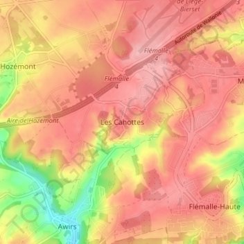
Name: Les Cahottes topographic map, elevation, terrain.
Location: Les Cahottes, Flémalle, Liège, Wallonie, 4400, Belgique (50.59571 5.40355 50.63571 5.44355)
Average elevation: 165 m
Minimum elevation: 84 m
Maximum elevation: 203 m
Thank you for supporting this site ❤️
Make a donation
Make a donation
Other topographic maps
Click on a map to view its topography, its elevation and its terrain.