
Tullynacree topographic map
Interactive map
Click on the map to display elevation.
About this map
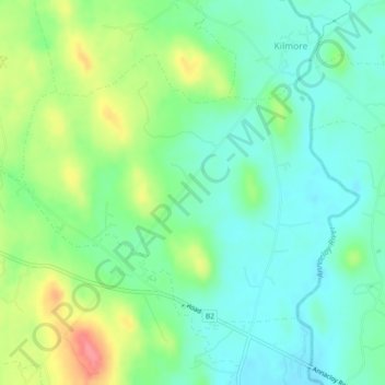
Name: Tullynacree topographic map, elevation, terrain.
Average elevation: 28 m
Minimum elevation: 3 m
Maximum elevation: 80 m
Other topographic maps
Click on a map to view its topography, its elevation and its terrain.
Lisnamore
Royaume-Uni > Irlande du Nord > Crossgar
Lisnamore, Crossgar, County Down, Irlande du Nord, Royaume-Uni
Average elevation: 30 m
Crossgar
Royaume-Uni > Irlande du Nord > Crossgar
Crossgar, County Down, Irlande du Nord, BT30 9HJ, Royaume-Uni
Average elevation: 34 m